The FEMA Elevation Certificate plays a crucial role in the National Flood Insurance Program (NFIP), serving as an essential administrative tool for both property owners and communities. This form collects vital elevation information to ensure compliance with local floodplain management ordinances and to accurately determine flood insurance premium rates. It is particularly important for buildings constructed after the publication of the Flood Insurance Rate Map (FIRM), as it helps assess the risk of flooding in designated Special Flood Hazard Areas. To obtain flood insurance or to support a request for a Letter of Map Amendment (LOMA) or Letter of Map Revision based on fill (LOMR-F), the Elevation Certificate must be completed and submitted. It requires detailed information about the property, including the lowest floor elevation, which must be certified by a licensed surveyor, engineer, or architect. Additionally, the form provides a means for communities to document their compliance with federal requirements aimed at reducing flood losses. While the completion of the Elevation Certificate is voluntary, failing to provide the necessary information can result in higher insurance premiums or the inability to secure flood insurance altogether. Therefore, understanding the intricacies of this form is vital for homeowners and community officials alike.
NATIONAL FLOOD INSURANCE PROGRAM
ELEVATION CERTIFICATE
AND
INSTRUCTIONS
2019 EDITION
OMB No.
Expiration Date: November 30, 2022
U.S. DEPARTMENT OF HOMELAND SECURITY
Federal Emergency Management Agency
National Flood Insurance Program
ELEVATION CERTIFICATE AND INSTRUCTIONS
Paperwork Reduction Act Notice
Public reporting burden for this data collection is estimated to average 3.75 hours per response. The burden estimate includes the time for reviewing instructions, searching existing data sources, gathering and maintaining the data needed, and completing and submitting this form. You are not required to respond to this collection of information unless a valid OMB control number is displayed on this form. Send comments regarding the accuracy of the burden estimate and any suggestions for reducing the burden to: Information Collections Management, Department of Homeland Security, Federal Emergency Management Agency, 500 C Street SW, Washington, DC 20742, Paperwork Reduction Project
Privacy Act Statement
Authority: Title 44 CFR § 61.7 and 61.8.
Principal Purpose(s): This information is being collected for the primary purpose of estimating the risk premium rates necessary to provide flood insurance for new or substantially improved structures in designated Special Flood Hazard Areas.
Routine Use(s): The information on this form may be disclosed as generally permitted under 5 U.S.C. § 552a(b) of the Privacy Act of 1974, as amended. This includes using this information as necessary and authorized by the routine uses published in DHS/
Disclosure: The disclosure of information on this form is voluntary; however, failure to provide the information requested may result in the inability to obtain flood insurance through the National Flood Insurance Program or the applicant may be subject to higher premium rates for flood insurance. Information will only be released as permitted by law.
Purpose of the Elevation Certificate
The Elevation Certificate is an important administrative tool of the National Flood Insurance Program (NFIP). It is to be used to provide elevation information necessary to ensure compliance with community floodplain management ordinances, to determine the proper insurance premium rate, and to support a request for a Letter of Map Amendment (LOMA) or Letter of Map Revision based on fill
The Elevation Certificate is required in order to properly rate
As part of the agreement for making flood insurance available in a community, the NFIP requires the community to adopt floodplain management regulations that specify minimum requirements for reducing flood losses. One such requirement is for the community to obtain the elevation of the lowest floor (including basement) of all new and substantially improved buildings, and maintain a record of such information. The Elevation Certificate provides a way for a community to document compliance with the community's floodplain management ordinance.
Use of this certificate does not provide a waiver of the flood insurance purchase requirement. Only a LOMA or
This certificate is used only to certify building elevations. A separate certificate is required for floodproofing. Under the NFIP, non- residential buildings can be floodproofed up to or above the Base Flood Elevation (BFE). A floodproofed building is a building that has been designed and constructed to be watertight (substantially impermeable to floodwaters) below the BFE. Floodproofing of residential buildings is not permitted under the NFIP unless FEMA has granted the community an exception for residential floodproofed basements. The community must adopt standards for design and construction of floodproofed basements before FEMA will grant a basement exception. For both floodproofed
Additional guidance can be found in FEMA Publication
FEMA Form |
Replaces all previous editions. |

U.S. DEPARTMENT OF HOMELAND SECURITY Federal Emergency Management Agency
National Flood Insurance Program
OMB No.
Expiration Date: November 30, 2022
ELEVATION CERTIFICATE
Important: Follow the instructions on pages
Copy all pages of this Elevation Certificate and all attachments for (1) community official, (2) insurance agent/company, and (3) building owner.
|
|
SECTION A – PROPERTY INFORMATION |
FOR INSURANCE COMPANY USE |
|
|
A1. Building Owner's Name |
Policy Number: |
||
|
|
|
|
|
|
A2. Building Street Address (including Apt., Unit, Suite, and/or Bldg. No.) or P.O. Route and |
Company NAIC Number: |
||
|
Box No. |
|
||
|
|
|
|
|
|
|
|
|
|
|
City |
State |
ZIP Code |
|
A3. Property Description (Lot and Block Numbers, Tax Parcel Number, Legal Description, etc.)
A4. Building Use (e.g., Residential, |
|
|
|
|
|
|
|||||||||||||||
A5. Latitude/Longitude: Lat. |
|
|
|
|
|
Long. |
|
|
|
Horizontal Datum: |
NAD 1927 |
NAD 1983 |
|||||||||
A6. Attach at least 2 photographs of the building if the Certificate is being used to obtain flood insurance. |
|
|
|
|
|||||||||||||||||
A7. Building Diagram Number |
|
|
|
|
|
|
|
|
|
|
|
|
|
|
|
|
|
|
|
||
A8. For a building with a crawlspace or enclosure(s): |
|
|
|
|
|
|
|||||||||||||||
a) |
Square footage of crawlspace or enclosure(s) |
|
sq ft |
|
|
|
|
||||||||||||||
|
|
|
|
|
|
|
|
|
|
|
|
|
|||||||||
b) |
Number of permanent flood openings in the crawlspace or enclosure(s) within 1.0 foot above adjacent grade |
|
|
|
|||||||||||||||||
c) |
Total net area of flood openings in A8.b |
|
|
|
|
|
sq in |
|
|
|
|
|
|
||||||||
d) Engineered flood openings? |
Yes |
No |
|
|
|
|
|
|
|||||||||||||
A9. For a building with an attached garage: |
|
|
|
|
|
|
|
|
|
|
|
|
|
||||||||
a) |
Square footage of attached garage |
|
|
|
|
|
|
|
|
sq ft |
|
|
|
|
|
|
|||||
b) |
Number of permanent flood openings in the attached garage within 1.0 foot above adjacent grade |
|
|
|
|
||||||||||||||||
c) |
Total net area of flood openings in A9.b |
|
|
|
|
|
|
sq in |
|
|
|
|
|
|
|||||||
d) Engineered flood openings? |
Yes |
No |
|
|
|
|
|
|
|||||||||||||
SECTION B – FLOOD INSURANCE RATE MAP (FIRM) INFORMATION
B1. NFIP Community Name & Community Number
B2. County Name
B3. State
B4. Map/Panel
Number
B5. Suffix
B6. FIRM Index Date
B7. FIRM Panel
Effective/
Revised Date
B8. Flood Zone(s)
B9. Base Flood Elevation(s)
(Zone AO, use Base Flood Depth)
B10. Indicate the source of the Base Flood Elevation (BFE) data or base flood depth entered in Item B9:
FIS Profile |
FIRM |
Community Determined |
Other/Source: |
B11. Indicate elevation datum used for BFE in Item B9: NGVD 1929 |
NAVD 1988 |
Other/Source:
B12. Is the building located in a Coastal Barrier Resources System (CBRS) area or Otherwise Protected Area (OPA)? |
Yes |
No |
|||
Designation Date: |
|
CBRS |
OPA |
|
|
FEMA Form |
Replaces all previous editions. |
Form Page 1 of 6 |
ELEVATION CERTIFICATE
OMB No.
Expiration Date: November 30, 2022
IMPORTANT: In these spaces, copy the corresponding information from Section A. |
FOR INSURANCE COMPANY USE |
|||
Building Street Address (including Apt., Unit, Suite, and/or Bldg. No.) or P.O. Route and Box No. |
Policy Number: |
|||
|
|
|
|
|
City |
State |
ZIP Code |
Company NAIC Number |
|
|
|
|
|
|
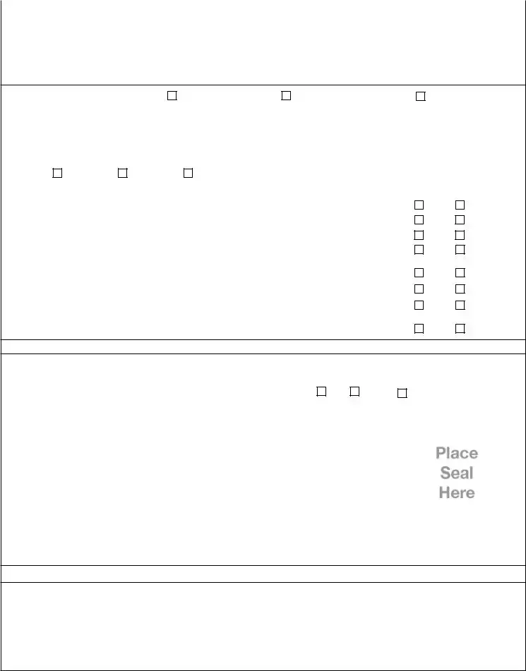
SECTION C – BUILDING ELEVATION INFORMATION (SURVEY REQUIRED)
C1. Building elevations are based on: |
Construction Drawings* |
Building Under Construction* |
Finished Construction |
*A new Elevation Certificate will be required when construction of the building is complete. |
|
||
C2. Elevations – Zones
Benchmark Utilized: |
|
|
|
|
Vertical Datum: |
|
|
|
|
|
||
Indicate elevation datum used for the elevations in items a) through h) below. |
|
|
|
|
||||||||
|
NGVD 1929 |
NAVD 1988 |
Other/Source: |
|
|
|
|
|
||||
Datum used for building elevations must be the same as that used for the BFE. |
Check the measurement used. |
|||||||||||
|
|
|
|
|
|
|
|
|
||||
a) |
Top of bottom floor (including basement, crawlspace, or enclosure floor) |
|
feet |
meters |
||||||||
b) |
Top of the next higher floor |
|
|
|
|
|
|
feet |
meters |
|||
c) |
Bottom of the lowest horizontal structural member (V Zones only) |
|
|
feet |
meters |
|||||||
d) |
Attached garage (top of slab) |
|
|
|
|
|
|
feet |
meters |
|||
e) |
Lowest elevation of machinery or equipment servicing the building |
|
feet |
meters |
||||||||
|
(Describe type of equipment and location in Comments) |
|
|
|||||||||
|
|
|
feet |
meters |
||||||||
f) |
Lowest adjacent (finished) grade next to building (LAG) |
|
|
|||||||||
g) |
Highest adjacent (finished) grade next to building (HAG) |
|
|
feet |
meters |
|||||||
h) |
Lowest adjacent grade at lowest elevation of deck or stairs, including |
|
feet |
meters |
||||||||
|
structural support |
|
|
|
|
|
|
|
||||
SECTION D – SURVEYOR, ENGINEER, OR ARCHITECT CERTIFICATION
This certification is to be signed and sealed by a land surveyor, engineer, or architect authorized by law to certify elevation information. I certify that the information on this Certificate represents my best efforts to interpret the data available. I understand that any false statement may be punishable by fine or imprisonment under 18 U.S. Code, Section 1001.
Were latitude and longitude in Section A provided by a licensed land surveyor? |
Yes |
No |
Check here if attachments. |
||
|
|
|
|
|
|
Certifier's Name |
License Number |
|
|
|
|
|
|
|
|
|
|
Title |
|
|
|
|
|
|
|
|
|
|
|
Company Name |
|
|
|
|
|
|
|
|
|
|
|
Address |
|
|
|
|
|
|
|
|
|
|
|
City |
State |
ZIP Code |
|
|
|
|
|
|
|
|
|
Signature |
Date |
Telephone |
|
Ext. |
|
Copy all pages of this Elevation Certificate and all attachments for (1) community official, (2) insurance agent/company, and (3) building owner. Comments (including type of equipment and location, per C2(e), if applicable)
FEMA Form |
Replaces all previous editions. |
Form Page 2 of 6 |

ELEVATION CERTIFICATE |
|
|
OMB No. |
|
|
|
Expiration Date: November 30, 2022 |
||
IMPORTANT: In these spaces, copy the corresponding information from Section A. |
FOR INSURANCE COMPANY USE |
|||
Building Street Address (including Apt., Unit, Suite, and/or Bldg. No.) or P.O. Route and Box No. |
Policy Number: |
|||
|
|
|
|
|
City |
State |
ZIP Code |
Company NAIC Number |
|
SECTION E – BUILDING ELEVATION INFORMATION (SURVEY NOT REQUIRED)
FOR ZONE AO AND ZONE A (WITHOUT BFE)
For Zones AO and A (without BFE), complete Items
E1. Provide elevation information for the following and check the appropriate boxes to show whether the elevation is above or below the highest adjacent grade (HAG) and the lowest adjacent grade (LAG).
a)Top of bottom floor (including basement, crawlspace, or enclosure) is
b)Top of bottom floor (including basement, crawlspace, or enclosure) is
feet |
meters |
above or |
below the HAG. |
feet |
meters |
above or |
below the LAG. |
E2. |
For Building Diagrams |
||||||||
|
the next higher floor (elevation C2.b in |
|
|
|
|
feet |
meters |
above or |
below the HAG. |
|
the diagrams) of the building is |
|
|
|
|
||||
E3. |
Attached garage (top of slab) is |
|
|
|
|
feet |
meters |
above or |
below the HAG. |
|
|
|
|
||||||
E4. |
Top of platform of machinery and/or equipment |
|
|
|
|
|
|
|
|
|
servicing the building is |
|
|
|
|
feet |
meters |
above or |
below the HAG. |
|
|
|
|
|
|||||
E5. |
Zone AO only: If no flood depth number is available, is the top of the bottom floor elevated in accordance with the community's |
||||||||
|
floodplain management ordinance? |
Yes |
No |
Unknown. The local official must certify this information in Section G. |
|||||
SECTION F – PROPERTY OWNER (OR OWNER'S REPRESENTATIVE) CERTIFICATION
The property owner or owner's authorized representative who completes Sections A, B, and E for Zone A (without a
Property Owner or Owner's Authorized Representative's Name
|
Address |
City |
State |
ZIP Code |
|
|
|
|
|
|
|
|
Signature |
Date |
Telephone |
|
|
|
|
|
|
|
|
|
Comments |
|
|
|
|
|
|
Check here if attachments. |
|
|
|
FEMA Form |
Replaces all previous editions. |
Form Page 3 of 6 |

ELEVATION CERTIFICATE |
|
|
OMB No. |
|
|
|
Expiration Date: November 30, 2022 |
||
IMPORTANT: In these spaces, copy the corresponding information from Section A. |
FOR INSURANCE COMPANY USE |
|||
Building Street Address (including Apt., Unit, Suite, and/or Bldg. No.) or P.O. Route and Box No. |
Policy Number: |
|||
|
|
|
|
|
City |
State |
ZIP Code |
Company NAIC Number |
|
|
|
|
|
|
SECTION G – COMMUNITY INFORMATION (OPTIONAL)
The local official who is authorized by law or ordinance to administer the community's floodplain management ordinance can complete Sections A, B, C (or E), and G of this Elevation Certificate. Complete the applicable item(s) and sign below. Check the measurement used in Items
G1.
The information in Section C was taken from other documentation that has been signed and sealed by a licensed surveyor, engineer, or architect who is authorized by law to certify elevation information. (Indicate the source and date of the elevation data in the Comments area below.)
G2.
G3.
A community official completed Section E for a building located in Zone A (without a
The following information (Items
G4. Permit Number
G5. Date Permit Issued
G6. Date Certificate of Compliance/Occupancy Issued
G7. This permit has been issued for: |
New Construction |
Substantial Improvement |
G8. Elevation of
G9. BFE or (in Zone AO) depth of flooding at the building site:
G10. Community's design flood elevation:
Local Official's Name |
Title |
feet meters Datum
feet meters Datum
feet meters Datum
Community Name |
Telephone |
Signature |
Date |
Comments (including type of equipment and location, per C2(e), if applicable)
Check here if attachments.
FEMA Form |
Replaces all previous editions. |
Form Page 4 of 6 |

ELEVATION CERTIFICATE |
BUILDING PHOTOGRAPHS |
OMB No. |
||
See Instructions for Item A6. |
Expiration Date: November 30, 2022 |
|||
IMPORTANT: In these spaces, copy the corresponding information from Section A. |
FOR INSURANCE COMPANY USE |
|||
Building Street Address (including Apt., Unit, Suite, and/or Bldg. No.) or P.O. Route and Box No. |
Policy Number: |
|||
|
|
|
|
|
City |
State |
ZIP Code |
Company NAIC Number |
|
|
|
|
|
|
If using the Elevation Certificate to obtain NFIP flood insurance, affix at least 2 building photographs below according to the instructions for Item A6. Identify all photographs with date taken; "Front View" and "Rear View"; and, if required, "Right Side View" and "Left Side View." When applicable, photographs must show the foundation with representative examples of the flood openings or vents, as indicated in Section A8. If submitting more photographs than will fit on this page, use the Continuation Page.
|
Photo One |
||
Photo One Caption |
|
Clear Photo One |
|
|
|
|
|
|
Photo Two |
||
Photo Two Caption |
|
Clear Photo Two |
|
|
|
|
|
FEMA Form |
Replaces all previous editions. |
Form Page 5 of 6 |

ELEVATION CERTIFICATE |
BUILDING PHOTOGRAPHS |
OMB No. |
|
|
Continuation Page |
Expiration Date: November 30, 2022 |
|
IMPORTANT: In these spaces, copy the corresponding information from Section A. |
FOR INSURANCE COMPANY USE |
||
Building Street Address (including Apt., Unit, Suite, and/or Bldg. No.) or P.O. Route and Box No. |
Policy Number: |
||
|
|
|
|
City |
State |
ZIP Code |
Company NAIC Number |
|
|
|
|
If submitting more photographs than will fit on the preceding page, affix the additional photographs below. Identify all photographs with: date taken; "Front View" and "Rear View"; and, if required, "Right Side View" and "Left Side View." When applicable, photographs must show the foundation with representative examples of the flood openings or vents, as indicated in Section A8.
|
Photo Three |
Photo Three Caption |
Clear Photo Three |
|
Photo Four |
||
Photo Four Caption |
|
Clear Photo Four |
|
|
|
|
|
FEMA Form |
Replaces all previous editions. |
Form Page 6 of 6 |
| Fact Name | Details |
|---|---|
| Purpose | The Elevation Certificate is used to provide elevation information necessary for flood insurance and compliance with floodplain management regulations. |
| Required for Post-FIRM | This certificate is mandatory for buildings constructed after the Flood Insurance Rate Map (FIRM) publication in certain flood zones. |
| Community Compliance | Communities must adopt floodplain management regulations, which include obtaining and maintaining elevation records for new or improved structures. |
| LOMA/LOMR-F Support | The Elevation Certificate can support requests for a Letter of Map Amendment (LOMA) or Letter of Map Revision based on fill (LOMR-F). |
| Survey Requirement | A surveyor or engineer must certify the lowest floor and lowest adjacent grade elevations if the certificate supports a LOMA or LOMR-F request. |
| Voluntary Disclosure | Providing information on the form is voluntary, but failing to do so may affect flood insurance eligibility or premium rates. |
| Non-Residential Floodproofing | Non-residential buildings can be floodproofed, but a separate floodproofing certificate is required. |
| Governing Laws | The Elevation Certificate is governed by Title 44 CFR § 61.7 and 61.8, among other regulations. |
Completing the FEMA Elevation Certificate is a necessary step for property owners seeking flood insurance. This form collects vital elevation data and must be filled out accurately to ensure compliance with floodplain management regulations. Once the form is completed, it should be submitted to the relevant authorities, such as your insurance agent or community official, to facilitate the flood insurance process.
What is the purpose of the FEMA Elevation Certificate?
The FEMA Elevation Certificate is a key document used in the National Flood Insurance Program (NFIP). It provides essential elevation information needed to ensure compliance with local floodplain management regulations. This certificate helps determine the correct flood insurance premium rates and can support requests for a Letter of Map Amendment (LOMA) or Letter of Map Revision based on fill (LOMR-F).
Who needs to fill out the Elevation Certificate?
The Elevation Certificate must be completed for buildings that are newly constructed or substantially improved in designated Special Flood Hazard Areas. This includes properties in flood zones A1–A30, AE, AH, VE, and others. It is typically filled out by a licensed surveyor, engineer, or architect who can certify the elevation data.
What information is required on the Elevation Certificate?
The certificate requires several types of information, including the building owner's name, the property address, flood zone details, and various elevation measurements. These measurements include the height of the lowest floor, the highest adjacent grade, and other structural elevations. Additionally, photographs of the building are needed if the certificate is being used for flood insurance.
Is the Elevation Certificate necessary for older buildings?
For buildings constructed before the Flood Insurance Rate Map (FIRM) was published, the Elevation Certificate is not typically required unless the property owner opts to rate the building under the newer Post-FIRM flood insurance rules. In such cases, the certificate may be necessary.
What happens if I don't provide the Elevation Certificate?
If you do not submit the Elevation Certificate, you may face difficulties obtaining flood insurance through the NFIP. Additionally, you could be subject to higher premium rates for flood insurance. It is crucial to provide accurate information to avoid these issues.
Can the Elevation Certificate help with a LOMA request?
Yes, the Elevation Certificate can support a request for a LOMA or LOMR-F. When submitting a request, you will need to include the Elevation Certificate, along with other required forms. Certified elevations from a surveyor or engineer are necessary to strengthen your case for amending the flood map.
What is the difference between an Elevation Certificate and a floodproofing certificate?
The Elevation Certificate is specifically used to certify building elevations, while a floodproofing certificate is required for non-residential buildings that are designed to be watertight below the Base Flood Elevation (BFE). Each certificate serves a different purpose and requires different information.
Where can I find more information about the Elevation Certificate?
Additional guidance and resources regarding the Elevation Certificate can be found on FEMA's website. FEMA Publication 467-1, which focuses on floodplain management and the Elevation Certificate, is also available online for further reading.
Incomplete Information: Failing to fill out all required sections of the form can lead to delays. Each section must be completed thoroughly to ensure accurate processing.
Incorrect Elevation Data: Providing inaccurate measurements for the building's elevation can result in improper flood insurance rates. It is essential to verify all elevations against the correct benchmarks.
Missing Supporting Documentation: Not attaching the necessary photographs or additional documents can hinder the application process. Ensure all required attachments are included with the submission.
Failure to Use Correct Datum: Using an incorrect elevation datum when reporting the Base Flood Elevation (BFE) can lead to significant errors. Confirm that the datum used matches the one specified for the BFE.
Neglecting to Sign the Certificate: Omitting signatures from the property owner or the certifying engineer can invalidate the form. All required signatures must be present for the submission to be considered complete.
Not Consulting Local Regulations: Ignoring local floodplain management regulations can result in non-compliance. It is vital to be aware of and adhere to community-specific requirements when completing the form.
Submitting to the Wrong Address: Sending the completed form to an incorrect address can delay processing. Always verify the correct submission address as outlined in the instructions.
When navigating the complexities of flood insurance and compliance with federal regulations, several forms and documents accompany the FEMA Elevation Certificate. Each of these documents serves a specific purpose, ensuring that property owners and communities meet necessary guidelines. Understanding these forms can streamline the process and enhance compliance with floodplain management ordinances.
By familiarizing yourself with these documents, you can better navigate the requirements associated with flood insurance and elevation certification. Each form plays a vital role in ensuring compliance, protecting property, and potentially reducing insurance costs. Timely submission of these documents can significantly impact your flood insurance experience.
The FEMA Elevation Certificate is similar to the Floodproofing Certificate, which is also a critical document under the National Flood Insurance Program (NFIP). While the Elevation Certificate focuses on the elevation of buildings, the Floodproofing Certificate is specifically designed for non-residential structures that have been engineered to withstand floodwaters. Both documents require certification from a licensed professional, ensuring that the information provided is accurate and meets the program's standards. The Floodproofing Certificate also helps determine insurance premiums, just like the Elevation Certificate, by assessing the risk associated with flood exposure.
Another document that shares similarities with the FEMA Elevation Certificate is the Letter of Map Amendment (LOMA). A LOMA is a request made to FEMA to remove a property from the Special Flood Hazard Area (SFHA) designation. To support this request, property owners must provide elevation data, often obtained from an Elevation Certificate. Both documents play a role in determining flood insurance requirements and premiums, making them essential tools for property owners seeking to navigate flood risk management.
The Flood Insurance Rate Map (FIRM) serves as another related document. The FIRM outlines flood zones and base flood elevations, which are critical for understanding a property's flood risk. The Elevation Certificate uses this information to provide accurate elevation data for buildings. Both documents are interconnected, as the FIRM establishes the baseline for flood insurance premiums, while the Elevation Certificate provides the specific elevation details necessary for compliance with floodplain management regulations.
The Base Flood Elevation (BFE) data is yet another document that relates closely to the Elevation Certificate. The BFE indicates the height floodwaters are expected to reach during a base flood event, and this information is essential for determining insurance rates. When filling out the Elevation Certificate, property owners must reference the BFE to ensure their building meets the necessary elevation standards. Thus, the BFE serves as a foundational element that informs the data provided in the Elevation Certificate.
The Floodplain Management Ordinance is also similar in purpose to the Elevation Certificate. This ordinance sets the minimum standards for construction and development in flood-prone areas. Communities must adopt such ordinances to participate in the NFIP. The Elevation Certificate helps document compliance with these regulations by providing necessary elevation information for new and substantially improved structures. Both documents work together to reduce flood risks and promote safer building practices in flood-prone areas.
The Letter of Map Revision (LOMR) is another document that parallels the Elevation Certificate. A LOMR is issued by FEMA to officially change the flood map, often based on new data or changes in land use. When property owners seek a LOMR, they may need to submit an Elevation Certificate to demonstrate that their building is above the new base flood elevation. This connection underscores the importance of both documents in managing flood risk and ensuring that properties are accurately represented in floodplain maps.
The National Flood Insurance Program (NFIP) Community Rating System (CRS) application also shares similarities with the Elevation Certificate. The CRS encourages communities to implement floodplain management practices that exceed the minimum NFIP standards, potentially leading to discounts on flood insurance premiums. Elevation Certificates are often part of the documentation required for CRS applications, as they help demonstrate a community's commitment to reducing flood risk and enhancing public safety.
The Flood Insurance Application is another related document. This application collects information necessary to determine eligibility for flood insurance coverage. The Elevation Certificate often accompanies this application, as it provides the required elevation data that affects insurance rates. Both documents are integral to the process of securing flood insurance and ensuring compliance with NFIP requirements.
Lastly, the NFIP Compliance Checklist is akin to the Elevation Certificate in that it serves as a tool for communities to ensure they are meeting federal floodplain management requirements. This checklist helps verify that all necessary documents, including Elevation Certificates, are in place for properties within flood-prone areas. Both documents help communities maintain compliance with NFIP regulations and promote effective floodplain management practices.
When filling out the FEMA Elevation Certificate form, it's essential to follow certain guidelines to ensure accuracy and compliance. Here’s a list of things to do and avoid:
Understanding the FEMA Elevation Certificate is crucial for homeowners in flood-prone areas. However, several misconceptions can lead to confusion. Here are seven common misconceptions:
Addressing these misconceptions can help homeowners navigate the complexities of flood insurance and compliance with FEMA regulations more effectively.
Here are some key takeaways for filling out and using the FEMA Elevation Certificate: